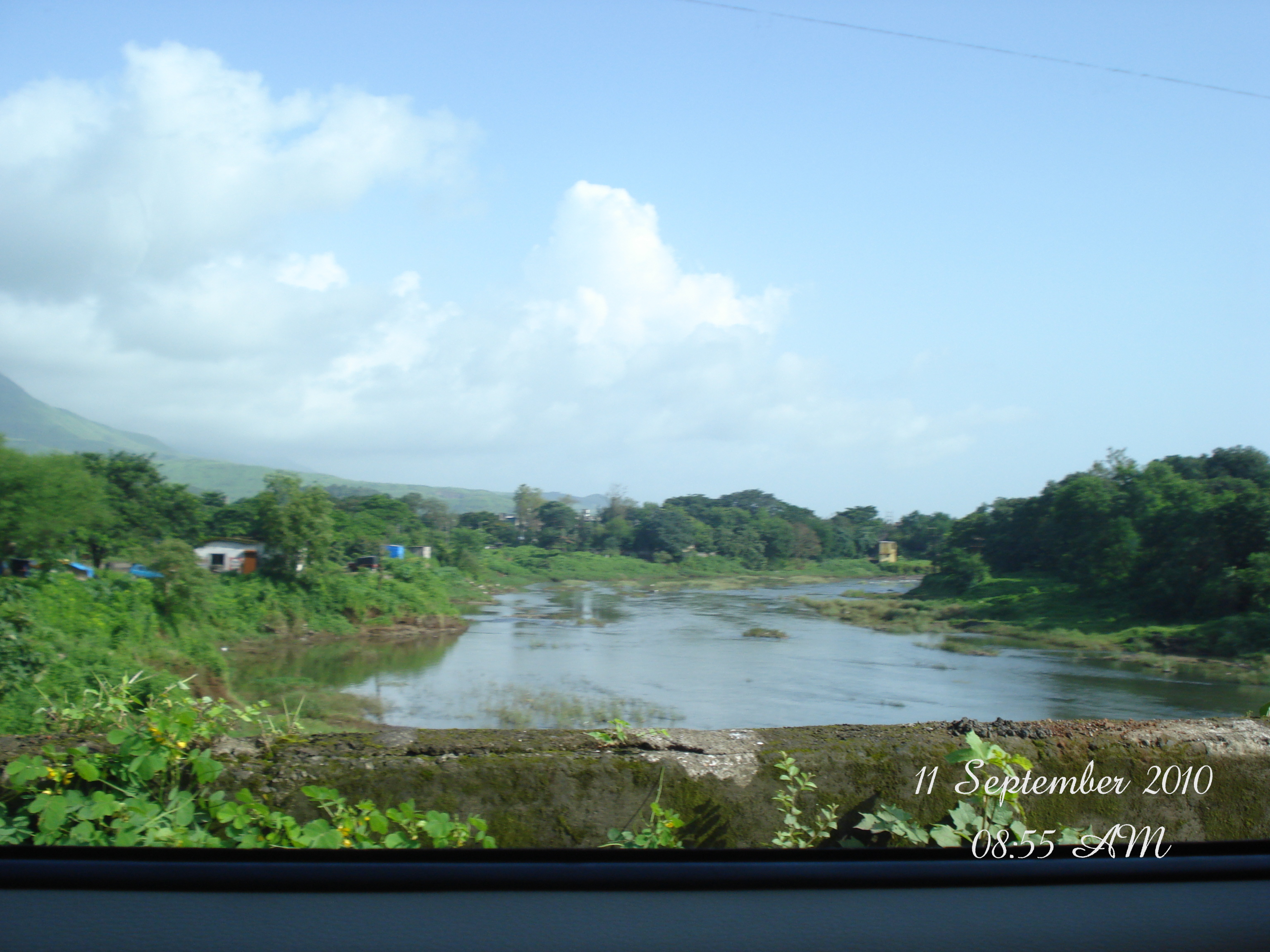
There is a very good reason why local trekkers crown the trail from Karjat to Bhimashankar as the "King of all Sahyadri Treks."
Unlike standard fort treks near Karjat like Kothaligad, or regional classics like Raigad, Rajgad, and Sinhagad, Bhimashankar throws absolutely everything at you. We are talking about a relentless, muscle-burning climb of over 850 m (2,788 ft) from the base village. It packs in wild river crossings, vertical rock scrambling, dense canopy walks through a wildlife sanctuary, and sheer steel ladders bolted straight into towering basalt cliffs.
If you are looking for an outdoor activity in Karjat that will test your legs, lungs, and nerves, here is exactly how we conquered this iconic Sahyadri crossing-and how you can plan your own successful trek.
Trek At-A-Glance
| Feature | Details |
|---|---|
| Starting Point | Khandas Village, Karjat Taluka |
| Trekking Distance | 8 km to 13 km (One-way, depending on route) |
| Duration | 3 to 4 hours (Ascent) |
| Peak Altitude | 1,008 m (3,307 ft) above sea level |
| Total Elevation Gain | ~850 m (2,788 ft) from base |
| Trail Difficulty | Shidi Ghat: Moderate to Difficult | Ganesh Ghat: Easy to Moderate |
| Best Season | Monsoon (June to September) or Post-Monsoon (October to March). Learn more in our best time to visit Karjat guide. |
The Journey to the Base: How We Got to Khandas
Our adventure started early in the morning. Getting to the trailhead is a multi-stage journey, but it is highly affordable and straightforward once you know the transport connections on how to reach Karjat.
- The Morning Train: We caught the morning Sinhagad Express from Shivajinagar around 06:12 AM and pulled into Karjat Station by 08:00 AM.
- The Local Bus: From Karjat, we headed to the local State Transport (MSRTC) bus stand and hopped on a rural bus bound for Kashele, which is a bustling hub about 22 km north on Murbad Road.
- The Shared Ride: Once we arrived at Kashele, we teamed up with another small group of trekkers to hire a local Maruti Omni. Splitting the private vehicle fare of ₹200 meant it cost us just ₹25 per commuter.
- The Warm-Up Walk: The Omni dropped us off in the quiet farming hamlet of Khandas Village at approx. 10:00 AM. But the real work does not start there! You have to complete a flat, scenic 3 km warm-up walk along a dirt road to reach the concrete bridge over the Shahi River.
By the time we stepped onto the bridge, it was 10:45 AM-and the massive, mist-shrouded Bhimashankar massif was looming directly above us. The view from Khandas village was breathtaking, with the flat plains suddenly giving way to the sheer, intimidating basalt cliffs of Bhimashankar.
The Big Choice: Shidi Ghat vs. Ganesh Ghat
At the bridge crossing, the road splits. Your decision here determines what kind of day you are going to have:
- The Right Fork (Ganesh Ghat): The "safer" option. It is a longer, more gradual climb that curves around the southern ridge of the mountain. It is highly scenic, beginner-friendly, and takes about 4 to 5 hours.
- The Straight Path (Shidi Ghat): The legendary "Ladder Route." It is significantly steeper, shorter, and highly technical. It features three iron ladders bolted onto vertical drops.
- The Left Fork: Avoid this-it only leads to a neighboring tribal village.
On our trek, the weather was surprisingly clear and the heavy morning rains had eased up. Because Ganesh Ghat was crowded with loud tour groups, we decided to tackle Shidi Ghat. Only about 5% of trekkers on the mountain choose this route, which promised us a quiet, thrilling, and wild ascent. Looking up at those vertical black rock faces, we knew we were heading straight up into the clouds.
Part 1: Climbing the Shidi Ghat (Ladder Route)
1. The Stream Crossing
Right from the bridge, the trail immediately turns vertical. Within 30 minutes of heavy breathing through the deciduous forest, we hit our first real obstacle: a rushing seasonal river flowing directly over a deep forest waterfall. During heavy downpours, this stream can become a raging torrent. We carefully picked our footing over the wet, slippery rocks and pushed through.
2. Bolted Iron Ladders
After an hour of continuous climbing over wet clay and scrambling up rock steps, we came face-to-face with the first of the three famous iron ladders.
Bolted directly into the sheer vertical basalt cliffs, climbing these is an absolute adrenaline rush. As I climbed, I took a second to look back: the forest canopy opened up, revealing massive, roaring waterfalls cascading down the valley while monsoon clouds sailed right beneath our feet.
To keep things safe, our group ascended one by one. The ladders are sturdy, but they can get incredibly slick in the wet monsoon mist. Scaling the ladder with nothing but a sheer drop and incredible Sahyadri views behind you is a memory that sticks.
3. Slabs and Exposed Traverses
Beyond the ladders, the trail did not ease up. We had to navigate narrow, exposed basalt ledges where a single misstep would mean a very bad day. This section requires active, hands-on scrambling. Under the monsoon rain, these rock channels double as mini-waterfalls, making good grip on your shoes absolutely vital. Slow, deliberate steps are the key to negotiating the narrow, exposed ledges of the upper Shidi Ghat route.
Part 2: The Halfway Mark and the Mental Battle
After about 2 hours of intense scrambling, we finally crested the rocky ridge and stepped onto a flat, open plateau.
This is the midway convergence point where the Shidi Ghat and Ganesh Ghat routes meet up. It is home to a few local huts, making it the perfect spot to sit on a wooden bench, catch your breath, and grab a hot cup of black tea, spicy pitla bhakri, or sweet lemon water.
But do not get too comfortable-the hardest physical and mental part of the trek is still ahead as we enter the deep, misty evergreen forest of the Bhimashankar Wildlife Sanctuary.
Navigating the "10 False Summits"
From the midway huts, the trail plunges into the core of the Bhimashankar Wildlife Sanctuary. The rocky scrambling is over, but it is replaced by a brutal, never-ending muddy climb through dense forest canopy.
This section is a massive psychological battle. The trail climbs sharply up muddy slopes and tree roots, flattens out briefly to make you think you have finally reached the top plateau, and then immediately throws another steep, muddy climb at you. This cycle of "false summits" repeated about 10 to 12 times for us! It is exhausting, but the cool, misty air of the sanctuary keeps you moving forward.
Reaching the Summit: Bhimashankar Temple
At around 03:15 PM-exactly 3.5 hours after we started climbing from the base bridge-the quiet forest suddenly gave way to a distant roar of voices. We had finally topped out onto the high-altitude plateau (1,008 m above sea level) near the steps of the historic Bhimashankar Temple.
The contrast was wild. We had spent hours in complete wilderness, and suddenly we were surrounded by thousands of people. Because it was the holy month of Shravan, there were easily over 2,00,000 devotees visiting the shrine that weekend. Standing near the temple grounds after 3.5 hours of intense, rewarding effort was highly fulfilling.
The temple itself is a gorgeous, ancient structure. The inner sanctum (Garbhagriha) features intricate 13th-century Hemadpanti carvings, while the outer hall was constructed in the 18th century by Nana Phadnavis.
Our Darshan Reality Check: We walked over to check the temple queue, but the line was massive. Devotees were waiting upwards of 5 to 6 hours in the pouring rain just to enter the sanctum. Recognizing that we still had a long journey back to Pune before the night set in, we decided to skip the queue, pay our respects from the outer courtyard, and head out to begin our journey home by 04:30 PM.
Essential Travel & Safety Matrix
If you are planning to head out to Khandas to tackle this legendary trail, keep these comparison metrics in mind:
| Parameter | Ganesh Ghat (Easy/Long) | Shidi Ghat (Tough/Short) |
|---|---|---|
| Best Suited For | Beginners, large groups, safe descents | Experienced trekkers, thrill-seekers |
| Climbing Time | 4 to 5.5 hours | 3.5 to 4 hours |
| Monsoon Risk | Low (Safe, clear forest path) | High (Slippery ladders, waterfall streams) |
| Navigation | Easy to follow; runs near Padar Fort | Highly technical; requires active scrambling |
What to Pack
- Deep-Lug Trekking Shoes: Do not try this in regular, flat-soled running sneakers. The wet basalt rock on Shidi Ghat and the steep mud slopes of the forest demand proper grip.
- Tons of Water: Carry at least 3 Liters of water per person. There are no stalls between the base bridge and the halfway huts.
- Offline Maps: Mobile network coverage is practically non-existent in the deep forest sections below the plateau. Always download offline GPS tracks before you start.
Planning a weekend getaway to Karjat? After completing this grueling trek, treat your tired muscles to a luxurious stay. Check out our curated list of premium resorts in Karjat for the ultimate recovery retreat.